Probing the Hazy Mysteries of Marine Clouds
Engineer Armin Sorooshian is leading a $30M NASA mission to help climate and weather modelers better understand how aerosol particles and meteorological processes affect cloud properties.

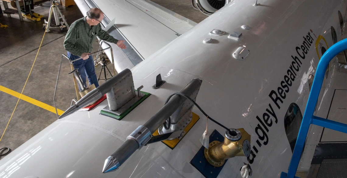
The HU-25 Falcon will fly under and through the clouds, where a suite of instruments will take samples directly from the surrounding air to measure everything from aerosol properties to droplet composition to gas. Instrument probes are visible here protruding from the top of the aircraft. (Photo: NASA / David C. Bowman)
Sea salt, soot, sulfate -- probably not the first words that come to mind when you think of clouds.
But as these and many other microscopic aerosol particles rise through the atmosphere, they act as nuclei on which water vapor can condense to form cloud droplets.
Because different kinds of aerosol particles affect the formation and evolution of clouds in ways that aren't entirely well understood, and because more data on that process will help researchers refine climate and weather models, it's a phenomenon ripe for an intensive field study.
A new NASA airborne science mission, led by chemical and environmental engineering professor Armin Sorooshian, will pick up that gauntlet by taking researchers on coordinated flights above, through and below the clouds over the western North Atlantic Ocean. The Aerosol Cloud Meteorology Interactions Over the Western Atlantic Experiment, or ACTIVATE, mission is scheduled to begin the first of six flight campaigns this week at NASA's Langley Research Center in Hampton, Virginia. Xubin Zeng, Agnese N. Haury Endowed Chair in Environment, professor of hydrology and atmospheric sciences, and director of the Climate Dynamics and Hydrometeorology Center at the UArizona College of Science, is the mission's deputy principal investigator.
Using two aircraft, a King Air and an HU-25 Falcon, ACTIVATE scientists will amass nearly 1,200 hours of coordinated flight data over the course of those campaigns. ACTIVATE data will help climate and weather modelers better understand how aerosol particles and meteorological processes affect cloud properties. In addition, modelers will use these data to better characterize how the clouds themselves, in turn, affect aerosol particle properties and atmospheric lifetime as well as the meteorological environment. Two-month-long flight campaigns will be spread out over the next three years, across different seasons and covering a slew of atmospheric conditions.
ACTIVATE will focus on marine boundary layer clouds — meaning clouds in the layer of the atmosphere closest to the ocean's surface. Those could range from thin stratiform clouds to thicker, deeper and more convective cumulus clouds.
"One big advantage of the western North Atlantic Ocean is its meteorological set up," said Sorooshian, ACTIVATE principal investigator. "That's one of the important reasons we picked this region. It's got a wide range of weather conditions, which leads to different cloud types."


